La Paz -Cabo San Lucas Baja California Mexico weather, Storm, and Hurricane tracking

Active storm warnings from National Hurricane Center
Aviso de ciclónes tropicales (Español)
EEBMIKE.COM en Español

Local weather station page - San Felipe to Manzanillo


Pacific Graphical Tropical Weather Outlook from National Hurricane center Miami florida

Tropical computer models from South Florida Water Management District or Weather Underground


Click here for more La Paz weather and 5 day forecast Click for Ciudad Constitucion, Mexico Forecast

Click for Loreto, Mexico Forecast Click for San Jose Del Cabo, Mexico Forecast

5 day forecast for Todos Santos BCS

Radar from La Paz
Look at time stamp (top left)

Radar from smn.cna.gob.mx/La Paz

Radar from Guasave
Radar from smn.cna.gob.mx/Guasave

More radar images from Servicio Meteorológico Nacional y Comisión Nacional del Agua

Sea surface temperature eastern Pacific and Sea of Cortez


Degrees Celsius Degrees Fahrenheit

Current pacific ocean hurricane sector satellite photo Visible Image


Hurricane path IR about 100K
Tropical Surface Analysis Chart

wind/wave Analysis Chart


Ocean view House for sale in Todos Santos

Last 24 hours from La Paz airport

Last 24 hours from Los Cabos airport

Key West weather

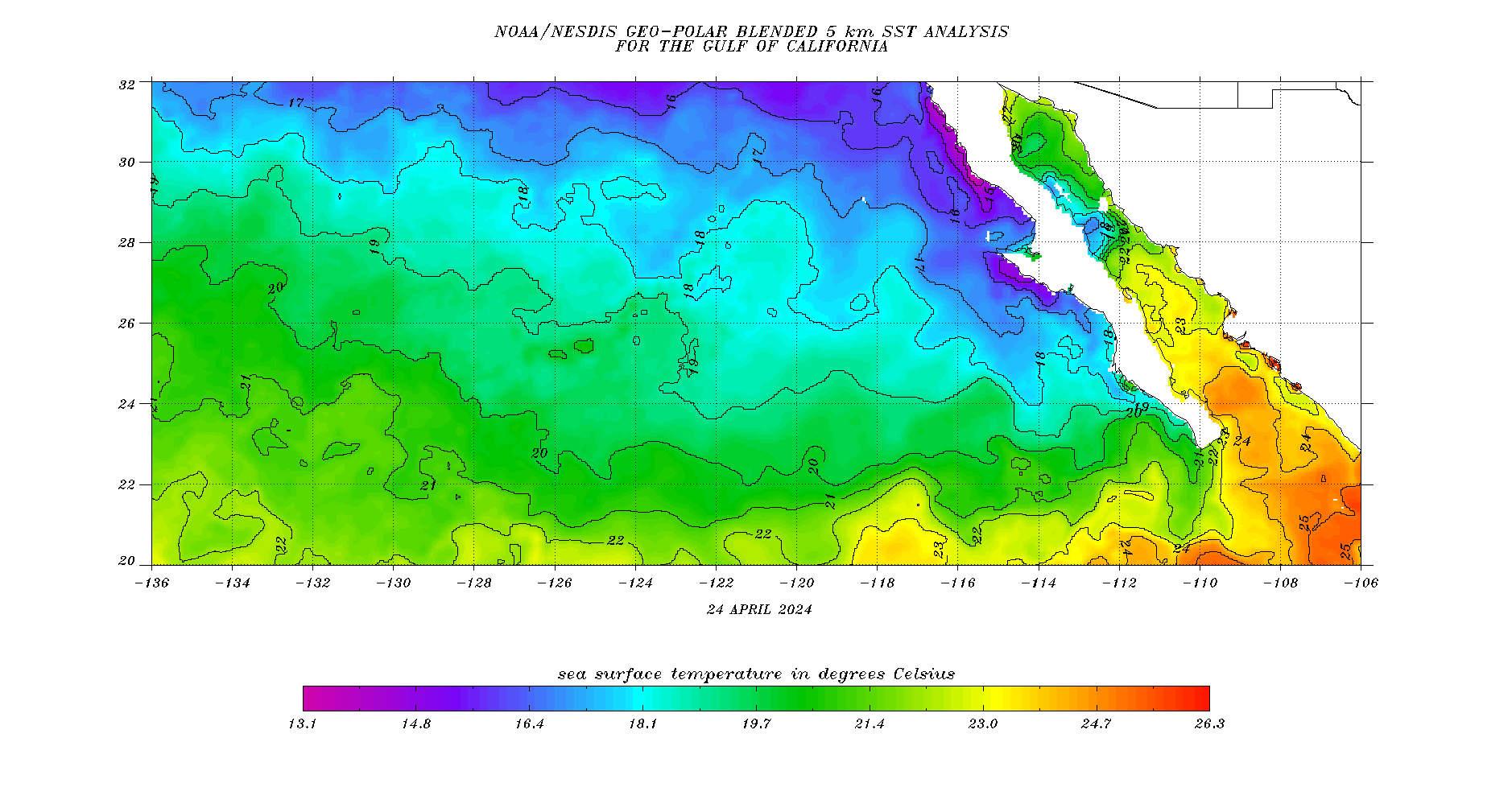
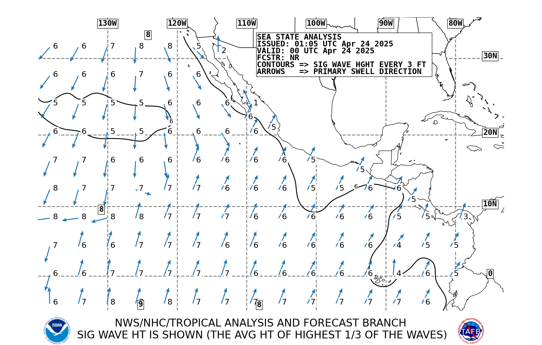
NWS Marine Charts East Pacific

Storm Tracks 1990 1991 1992 1993 1994 1995 1996 1997 1998 1999 2000 2001 2002 2003 2004 2005 2006 2007 2008 2009 2010

The ICE AGE is coming soon. Please help global warming ! ! Charts here

A Spanish-English on-line translator German,Italian,Portuguese,and French too!

Last 30 days Peso-Dollar Exchange rates  


Stats